
No alternative text

8D/7N
TREK FROM CHOQUEQUIRAO TO MACHU PICCHU

A timeless adventure between forgotten ruins and vertiginous Andean peaks

Home Tours Trek from Choquequirao to Machu Picchu

Connecting Choquequirao to Machu Picchu on foot is much more than a trek: it is a journey through time and through the landscapes of the Andean world.

Remote, demanding and deeply immersive, this itinerary takes you into the heart of a still-preserved territory, far from the classic routes. From the depths of the Apurímac Canyon to the peaks of the mountain range, and on to the edge of the tropical forest, each day reveals a new face of the Andes.

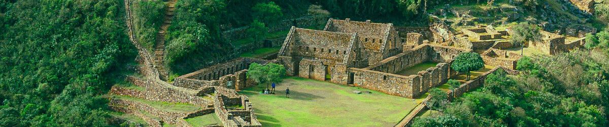
Along the way, you discover Choquequirao, often compared to Machu Picchu yet still largely hidden beneath the vegetation, before crossing isolated regions where nature and Andean traditions remain intact.

Gradually, the landscape changes, the high altitude giving way to lush vegetation, and the adventure leads to a first glimpse of Machu Picchu, discreet and unforgettable, before the final arrival at the site.

This trek is designed for those seeking an authentic experience far from the crowds, where physical effort, landscape diversity and cultural richness give the journey its full meaning.

Trip information

Tour title
Trek from Choquequirao to Machu Picchu
Duration
8D/7N
Difficulty
Challenging
Country visited
Peru
Regions crossed
Cusco, Apurimac
Highlights
Archaeological sites · Andean landscapes · Multi-climate journey · Culture · Local communities
Best time to come
From April to November
Accomodation
  • 1 night in 3 *
  • 1 night in accomodation at your own expense.
  • 6 nights in camp site
Meals included
7 breakfasts, 7 lunches, 6 dinners
Altitude max
4111 m a.s.l. / 13488 ft a.s.l.
Distance covered
240.8 km / 149.6 mi (* as the crow flies)
Recommended age
+14

Program details

1

Cusco - Cachora - Col de Capuliyoc - Chiquisca

On the Road to the First Stage

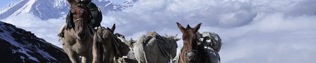
Departure from Cusco in the morning towards the village of Cachora, the gateway to this Andean adventure. There, you will meet the team who will accompany you throughout the trek: cooks, muleteers and their animals, the true craftsmen of this crossing.

Once the mules have been loaded with all the equipment, the walk begins towards the Capuliyoc Pass, at 2,800 m. Very quickly, the landscapes begin to change: from the vertiginous depths of the Apurímac Canyon to the snow-capped peaks rising above it, the Vilcabamba mountain range reveals all its majesty.

You then begin a gradual descent into the heart of the canyon, reaching Chiquisca, where your camp will be set up for the night in a natural setting of rare intensity.

Meals included : Lunch, Dinner
Accommodation :

Camp site

Altitudes

  • Altitude min : 1905 m a.s.l. / 6250 ft a.s.l.
  • Altitude max : 3400 m a.s.l. / 11155 ft a.s.l.

Distances (Referencials - as the crow flies)

  • Cusco - Cachora : 90.2 km /56 mi (road)
  • Cachora - Col de Capuliyoc : 7.8 km /4.8 mi (road)
  • Col de Capuliyoc - Chiquisca : 3.9 km /2.4 mi (walk)

Total distance : 101.9 km / 63.3 mi

2

Chiquisca - Playa Rosalina - Marampata - Raqaypata

From the Depths of the Apurímac Canyon to the Heights of Marampata, then to the Choquequirao Camp

From Chiquisca, the day begins with the crossing of the Apurímac Canyon before starting a sustained and gradual ascent towards the heights. The trail winds along the mountainside, offering spectacular views over the depths of the canyon and the surrounding landscapes.

This demanding yet steady climb leads you to the village of Marampata, a true natural balcony facing the site of Choquequirao. A well-deserved break allows you to regain your strength while enjoying an exceptional panorama.

At the end of the day, you continue to the Choquequirao camp, nestled in the heart of a wild and preserved environment. The atmosphere here is unique, between Andean silence and the first impressions of the Inca city, still wrapped in mystery.

Meals included : Breakfast, Lunch, Dinner
Accommodation :

Camp site

Altitudes

  • Altitude min : 1462 m a.s.l. / 4797 ft a.s.l.
  • Altitude max : 2875 m a.s.l. / 9432 ft a.s.l.

Distances (Referencials - as the crow flies)

  • Chiquisca - Playa Rosalina : 1.4 km /0.9 mi (road)
  • Playa Rosalina - Marampata : 2 km /1.2 mi (road)
  • Marampata - Raqaypata : 1.9 km /1.2 mi (road)

Total distance : 5.4 km / 3.4 mi

3

Raqaypata - Choquequirao - Abra Choquequirao - Pinchaunuyoc

Exploration of Choquequirao and Continuation of the Trek to Pinchauniyoc

The morning is dedicated to the discovery of Choquequirao, an impressive Inca city still preserved from mass tourism. Agricultural terraces, temples and ceremonial sectors gradually reveal themselves, offering a fascinating glimpse of this history-laden site, often compared to Machu Picchu.

After this exploration, you will enjoy lunch in the heart of this exceptional setting, facing the mountains of the Vilcabamba range.

In the afternoon, the trek continues towards the Pinchauniyoc camp. The trail crosses varied and wild landscapes, far from any human presence, deepening the feeling of immersion in the heart of the Andes.

Meals included : Breakfast, Lunch, Dinner
Accommodation :

Camp site

Altitudes

  • Altitude min : 2407 m a.s.l. / 7897 ft a.s.l.
  • Altitude max : 3377 m a.s.l. / 11079 ft a.s.l.

Distances (Referencials - as the crow flies)

  • Raqaypata - Choquequirao : 1 km /0.6 mi (walk)
  • Choquequirao - Abra Choquequirao : 1 km /0.6 mi (walk)
  • Abra Choquequirao - Pinchaunuyoc : 1.9 km /1.2 mi (walk)

Total distance : 3.9 km / 2.4 mi

4

Pinchaunuyoc - Río Blanco - El Maizal

Descent to the Río Blanco and Ascent to the El Maizal Camp

From Pinchaunuyoc, the trail gradually leaves the heights and plunges down into the depths of the canyon. The descent, sometimes steep, offers striking views of the surrounding landscapes, between dense vegetation and rugged reliefs.

You then reach the Río Blanco, at the bottom of the valley, where the atmosphere becomes warmer and more tropical. A welcome break allows you to regain your strength before tackling the second part of the day.

The ascent to El Maizal then begins, long and sustained. The path winds along the mountainside, revealing spectacular panoramas over the canyon at every turn. As you gain altitude, the landscapes change once again, returning to a more Andean atmosphere.

Arrival at the El Maizal camp at the end of the day, in an isolated and preserved setting, in the heart of the mountains.

Meals included : Breakfast, Lunch, Dinner
Accommodation :

Camp site

Altitudes

  • Altitude min : 1972 m a.s.l. / 6470 ft a.s.l.
  • Altitude max : 3000 m a.s.l. / 9843 ft a.s.l.

Distances (Referencials - as the crow flies)

  • Pinchaunuyoc - Río Blanco : 0.9 km /0.6 mi (walk)
  • Río Blanco - El Maizal : 1.4 km /0.9 mi (walk)

Total distance : 2.3 km / 1.4 mi

5

El Maizal - Minas Victoria - Abra San Juan - Yanama

Ascent to the Yanama Pass and Descent to the Village of Yanama

From El Maizal, the day begins with a gradual ascent through a high-mountain environment. The trail climbs through open, mineral landscapes, offering spectacular views of the peaks of the Vilcabamba range.

The effort leads you to the Yanama Pass, also known as Abra San Juan, the highest point of the trek, located at over 4,000 meters above sea level. From this emblematic pass, the panoramas are breathtaking, revealing the full grandeur of the Andes.

After this memorable stage, the descent begins towards the Yanama Valley. The landscapes gradually change, giving way to greener areas and a more noticeable human presence.

Arrival in the village of Yanama, where you return to a peaceful and authentic atmosphere after one of the most intense and spectacular days of the trek.

Meals included : Breakfast, Lunch, Dinner
Accommodation :

Camp site

Altitudes

  • Altitude min : 3000 m a.s.l. / 9843 ft a.s.l.
  • Altitude max : 4111 m a.s.l. / 13488 ft a.s.l.

Distances (Referencials - as the crow flies)

  • El Maizal - Minas Victoria : 3 km /1.9 mi (walk)
  • Minas Victoria - Abra San Juan : 0.7 km /0.4 mi (walk)
  • Abra San Juan - Yanama : 2.5 km /1.6 mi (walk)

Total distance : 6.2 km / 3.9 mi

6

Yanama - Totora - Lucmabamba

Descent from Yanama to Lucmabamba via Totora

From Yanama, the day begins with a gradual ascent towards the Yanama Pass, offering one final immersion in high-mountain landscapes. From this pass, the views stretch across the surrounding peaks, marking a transition between two worlds.

You then begin a long descent towards the valley, heading for Totora. The landscapes change rapidly: from mineral high-altitude expanses to the first signs of denser vegetation, announcing the gradual entrance into the tropical zone.

The trek continues to Lucmabamba, in the heart of a lush region where coffee plants, tropical fruits and abundant vegetation bear witness to this change of ecosystem. The atmosphere here becomes softer and warmer, contrasting with the previous days spent at high altitude.

Meals included : Breakfast, Lunch, Dinner
Accommodation :

Camp site

Altitudes

  • Altitude min : 2041 m a.s.l. / 6696 ft a.s.l.
  • Altitude max : 3511 m a.s.l. / 11519 ft a.s.l.

Distances (Referencials - as the crow flies)

  • Yanama - Totora : 13.7 km /8.5 mi (walk)
  • Totora - Lucmabamba : 17.4 km /10.8 mi (walk)

Total distance : 31.1 km / 19.3 mi

7

Lucmabamba - Llactapata - Hidroeléctrica Machupicchu - Mandor Pampa - Machupicchu Pueblo

From Lucmabamba to Machu Picchu Pueblo via Llactapata

From Lucmabamba, you follow an ancient Inca trail that gradually climbs through dense and lush vegetation. This ascent through the tropical forest offers a peaceful, shaded immersion, punctuated by viewpoints over the surrounding mountains.

You then reach the archaeological site of Llactapata, ideally located facing Machu Picchu. From this privileged viewpoint, a first rare and striking view opens onto the famous citadel, nestled among the mountains. It is one of the great moments of the trek, both discreet and spectacular.

After this discovery, the descent continues towards the valley, until you reach the railway line leading to Machu Picchu Pueblo, also known as Aguas Calientes. Arrival in this lively village marks the end of the trek and the imminent approach of the visit to Machu Picchu.

Meals included : Breakfast, Lunch
Accommodation :

Hotel Flower's House - 3* - Calle Kory Wakanki B-9 esquina, Ca. Wuyñay Wayna, Aguas Calientes - Machupicchu pueblo

Altitudes

  • Altitude min : 1778 m a.s.l. / 5833 ft a.s.l.
  • Altitude max : 2720 m a.s.l. / 8924 ft a.s.l.

Distances (Referencials - as the crow flies)

  • Lucmabamba - Llactapata : 4.4 km /2.7 mi (walk)
  • Llactapata - Hidroeléctrica Machupicchu : 3 km /1.9 mi (walk)
  • Hidroeléctrica Machupicchu - Mandor Pampa : 3.5 km /2.2 mi (walk)
  • Mandor Pampa - Machupicchu Pueblo : 1.8 km /1.1 mi (walk)

Total distance : 12.6 km / 7.8 mi

8

Machupicchu Pueblo - Machupicchu - Machupicchu Pueblo - Ollantaytambo - Cusco

Visit to Machu Picchu and Return by Train to Cusco via Ollantaytambo

After a night in Machu Picchu Pueblo, you set off early in the morning towards the citadel of Machu Picchu, one of the most emblematic sites in South America. Nestled between mountains and forest, this Inca wonder reveals its terraces, temples and ceremonial structures in a spectacular natural setting.

The guided visit will help you better understand the history, architecture and mysteries of this fascinating site, listed as a UNESCO World Heritage Site.

At the end of the visit, you return down to Machu Picchu Pueblo before boarding the train to Ollantaytambo, following the Urubamba Valley.

Upon arrival, transfer to Cusco, marking the end of this unforgettable adventure in the heart of the Andes.

Meals included : Breakfast
Accommodation :

Accomodation at your own expense.

Altitudes

  • Altitude min : 2081 m a.s.l. / 6827 ft a.s.l.
  • Altitude max : 3400 m a.s.l. / 11155 ft a.s.l.

Distances (Referencials - as the crow flies)

  • Machupicchu Pueblo - Machupicchu : 2.3 km /1.4 mi (road)
  • Machupicchu - Machupicchu Pueblo : 2.3 km /1.4 mi (road)
  • Machupicchu Pueblo - Ollantaytambo : 30.6 km /19 mi (train)
  • Ollantaytambo - Cusco : 42.2 km /26.2 mi (road)

Total distance : 77.3 km / 48 mi

Included

  1. All transport and transfers related to the trek, as well as the trains mentioned in the programme.
  2. Nights in camp and one night in a 3-star hotel in Machu Picchu Pueblo. The hotel mentioned in the programme is provided for reference only and is subject to availability. In case of unavailability, an equivalent establishment may be offered.
  3. All entrance fees to the sites indicated in the programme.
  4. English-speaking guide service throughout the trek and for the visit to Machu Picchu.
  5. Trekking equipment, kitchen equipment and tents.
  6. Meals mentioned as included.

Not included

  1. Meals indicated as free.
  2. Drinks during meals.
  3. Tips.
  4. Saddle horse.
  5. Sleeping bag, available for rent. Please let us know in advance.
  6. Visits not mentioned as included, which you may do freely.
  7. Excursions indicated as optional.
  8. Domestic and international flights.
  9. Cancellation and repatriation insurance.
  10. Bank fees related to payment for the trip.

You might also like

Home Tours Trek from Choquequirao to Machu Picchu

Upload en cours...